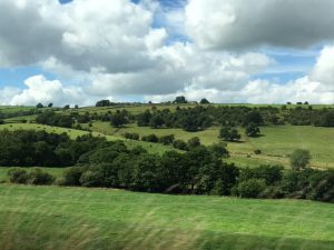
The day dawned rainy. Or maybe it didn’t really dawn at all. Hard to tell when the sky is a mass of grayness. But as it promised to clear by midday we headed out towards Derbyshire. (Where I am staying sits at the intersection of Staffordshire, Cheshire and Derbyshire, so we’ve visited all three shires in these 3 days). Over the hills towards Buxton we passed through tiny Flash, the highest village in England at 1,460 feet. We didn’t stop but the view through the vales and fields and hills was gorgeous despite the bleak sky.
Buxton is known as a spa town, for it’s healing waters. The Crescent was the centrepiece of the Fifth Duke of Devonshire’s plans to establish a fashionable Georgian spa town in Buxton. The building is one of the most architecturally significant buildings in the country and faces the site of St Ann’s Well, where warm spring water has flowed for thousands of years. The well is at the foot of The Slopes, a steep landscaped hillside in the centre of Buxton. Here mineral water flows from a mile below ground, to emerge at a constant 27.5 °C (81.5 °F). Currently undergoing re-furbishment to return to glory of the 1780’s, the town is growing around the project with a well-known Fringe Festival currently underway and an opera house dating from 1903. Quite charming.
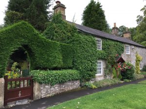
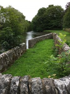
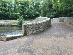
Then onto Ashford in the Water for a brief stop in what some call the prettiest village in Derbyshire. There on the Sheepwah Bridge is where ewes about to be sheared were herded over the medieval bridge to stone enclosures on one side, and their lambs to the other, forcing the ewes into the water for their pre-shearing bath as they naturally swam across the River Wye to rejoin their lambs.
Then onto Bakewell, known for it’s Bakewell Pudding and for the bridge with thousands of love locks, much like those elsewhere in the world. The “pudding” is actually a type of tart with an almond paste filling. Many shops claim to be the original, and of course I had to try one; my verdict: a little dry.
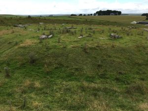
Lastly to Arbor Low, a low stone circle dating from about 3,000 BC — a contemporary of Stone Henge. Here too is the earthen ditch around a circle of stones, but these stones were never upright, so lay in the earth, and they are limestone, so likely from the area. Nearby is Gib Hill, a burial mound from 4,000 BC. It is believed that tomb sites such as these served as a focus for ceremonies linking the living and the dead and may have also marked the communities ownership of the surrounding land.
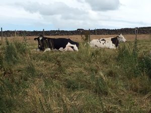
All of these shires are known for their dry stone walls which were used as border walls for farms as well as to manage livestock. While many have been removed to make for larger fields (the farmers in feudal times were given very narrow and small pieces of land to farm, which are too narrow for today’s farming machines), the walls are still a signature element of the landscape and beautiful to behold. We drove along past green, green fields, dotted with sheep and black and white cows (resembling dominoes from a distance), and city life seemed very far away. (Many cows were laying down today, which, according to Lynn’s mother Gil, means that rain is in the forecast! Or shall I say more rain!)
And that was Thursday.






Lorrie…once again love to read about your adventures. You are a wonderful writer and how you get all the details in is beyond me. Know these areas well and have seen many of them over the years. Enjoy every minute.